Park #6 – Hanging Rock

Date visited: April 8, 2017

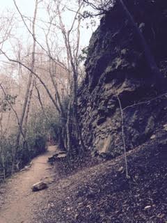
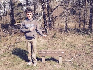
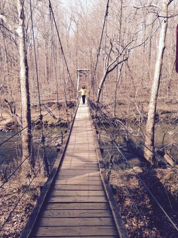
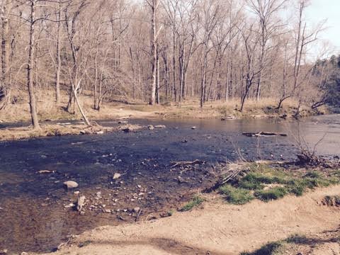
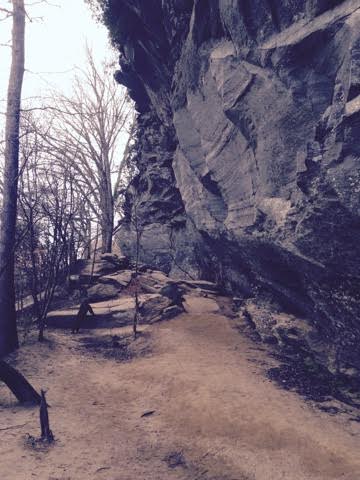
Hanging Rock State Park is located just outside the Piedmont in the Mountain region of the state. It is located approximately 30 miles north of Winston-Salem. For our drive there, it was mostly two lane highway and stops through various small, sleepy little towns after passing Greensboro. The final town we drove through was Danbury which is where Hanging Rock is located. After hitting the state park road, it was all uphill to the visitor center. We arrived early in the morning with few people around so we were able to talk to the park assistant and a few rangers about the park. After establishing our hiking plan, we took one more pit stop back to the car for extra clothing because it was quite cool! We started by hiking the Upper Cascades Trail there and back (0.6 miles) which was a NC TRACK Trail and wheelchair accessible. I should mention that NC TRACK Trails are self-guided trails designed as a way to promote physical activity and explore nature for children and their families. Each TRACK Trail has a trail head sign with self-guided brochures that can be used while exploring. Children and families can earn prizes for visiting trails and for tracking distance. At the end of the trail was a great view of the Upper Cascades waterfall and the sound of running water truly reminded me of the mountains. On our way back from the trail, we tried a little Parkour at the rock garden. Let’s just say we’ll stick with hiking!

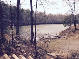
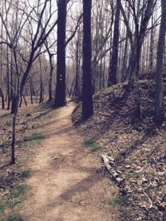
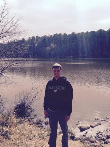
Next up was the main hike, the Hanging Rock Trail. There and back gave us a distance of 2.6 miles. After a steady uphill climb, we made it to a staircase which led to the top of Hanging Rock Mountain. At the top, there were clear skies in all directions giving a view of the Blue Ridge Mountains in Virginia, Moore’s Knob, and downtown Winston-Salem. At that time, we decided to sit for a while, enjoy the sunshine, and take in the surroundings. After our hike down the mountain, we made our way back to the visitor center. On our way to the restrooms, we noticed a man and a woman by the entrance. We both looked at each other and thought that was strange. Come to find out, they both were evangelizing with a wide selection of Christian pamphlets. Don’t get me wrong religion has its place, but at a state park visitor center? Interested to know more, we asked the park attendant if people can hand out information of their choosing and the answer is yes! Before leaving the park, we drove to a picnic area overlooking a lake. That made for a great way to finish our visit. I have to say that Hanging Rock was definitely one of the most scenic state parks we visited yet offering a wide variety of trails, waterfall views, a lake, and more.

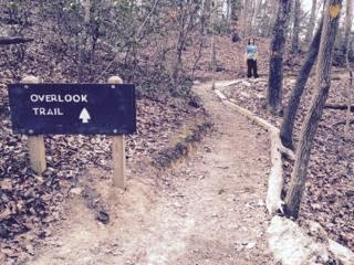
Picture One – NC TRACK Trail and Start of Upper Cascades Trail

Hanging Rock 4-9-17

Picture Two – I’m at the Upper Cascades Falls
Hanging Rock 2 4-9-17

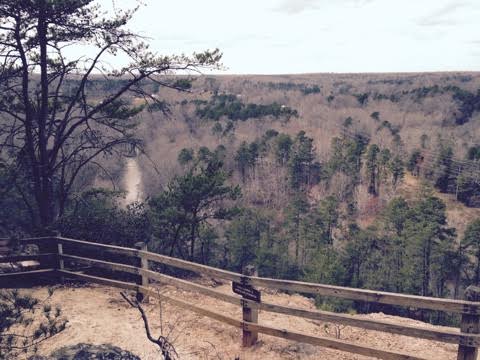
Picture Three – Overlook on Hanging Rock viewing Moore’s Knob

Hanging Rock 4 4-9-17

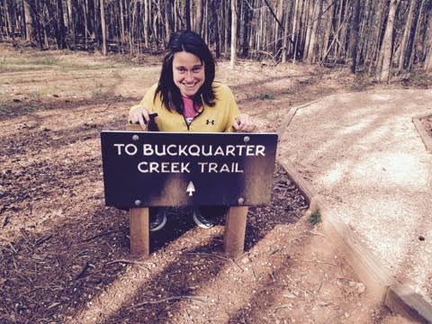
Picture Four – Rebecca and I on Hanging Rock Mountain overlooking Moore’s Knob

Hanging Rock 6 4-9-17

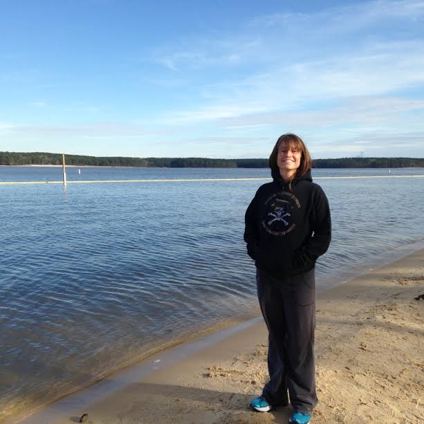
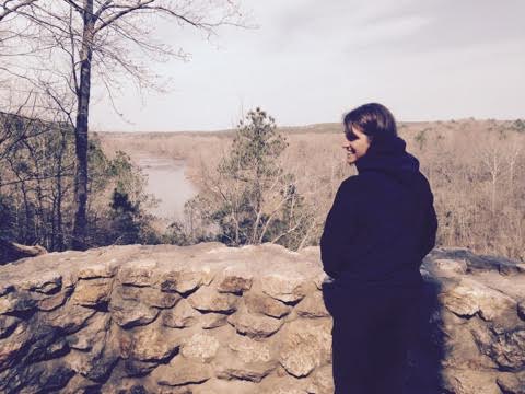
Picture Five – Lake at Hanging Rock

Hanging Rock 9 4-9-17

Park #5 – Jordan Lake

Date visited: March 11, 2017

Jordan Lake is considered a recreation area rather than a state park. This means that there are intensive facilities to support all the participant activities. The lake spans in Wake and Chatham County. The closest towns to the lake are Apex and Pittsboro. Jordan Lake is mostly known for water activities. Since the temperature was cool, we knew we wanted to hike at only one of the many areas along the lake. We started by going to the visitor center on the Apex side of the lake to obtain our stamp. While there, we decided to hike and visit the Seaforth area. Great, I thought. This decision is made. As we were leaving  the center, we couldn’t help but notice a heated conversation between a ranger and fisherman about the importance of visitors not parking in staff designated areas. After hearing that, we wanted to make sure we parked were we were supposed to!

We drove to the Seaforth area located on the Pittsboro side of the lake. We hiked the one and only Pond Trail (1.4 miles) which was a loop starting and ending at our parking spot. To sum up the hike, we walked around a pine forest with small ponds nearby, and two points of access to the lake. I particularly enjoyed walking on the flat, sandy surface reminding me of terrain in the eastern part of the state.

Picture – Rebecca in front of Jordan Lake at Seaforth

Jordan Lake 2 3-11-17


Park #4 – Occoneechee Mountain

Date visited: March 7, 2017

The third trail, second park, and final stop on day two brought us to Occoneechee Mountain in Hillsborough, NC. Occoneechee Mountain is actually considered a natural area instead of a state park meaning that the area has limited facilities for visitors. In fact, there is only one gravel parking lot and one restroom there. This area is located in close proximity to Eno River State Park but gives more elevation. We hiked the Occoneechee Mountain Loop Trail (2.2 miles). The highlight was reaching the summit at nearly 900 feet, overlooking the highest point in Orange County, and seeing the Eno River below.

Picture One – A rock face on the Occoneechee Mountain Loop Trail

Oco Mtn 3 3-7-17

Picture Two – The trail leads to…Rebecca!

Oco Mtn 1 3-7-17

Picture Three – Mountain summit from overlook

Oco Mtn 2 3-7-17

Mountains-To-Sea Trail

Date visited: March 7, 2017

Stop two of day two brought us to a portion of the Mountains-To-Sea (MTS) Trail along the Eno River. The MTS Trail is 1,175 miles long and goes as far west as Clingman’s Dome at the Great Smoky Mountains and as far east as Jockey’s Ridge at the Outer Banks. Slightly over half of the trail is complete in disconnected parts across the state.

We started on the trail at the Pleasant Green parking area located a few miles from the Eno River State Park visitor center. From there, we hiked along the Laurel Bluffs Trail to the Eno Rock Quarry and back (2.8 miles). The winding trail had comfortable dirt footing that kept us near the Eno River. After hiking 1.4 miles, we came to the Eno Rock Quarry that resembled a large pond where rocks were plentiful.

Picture One – I’m near the parking area on the Laurel Bluffs Trail

Eno River MTS 1 3-7-17

Picture Two – Eno Rock Quarry

Eno River MTS 2 3-7-17

Picture Three – MTS Trail near Eno Rock Quarry

Eno River MTS 3 3-7-17


Park #3 – Eno River

Date visited: March 7, 2017

This park is located roughly 10 miles northwest of Durham, NC. We started by going to the visitor center where the knowledgeable park attendant gave us our stamp and shared with us information about the park, the nearby Mountains-To-Sea Trail (MST), and Occconeechee Mountain State Park. After talking with the attendant, I told her to give us the other stamps too as I was motivated to visit the other places that day! At Eno, we hiked the Buckquarter Creek Trail (1.5 miles) which was conveniently located behind the visitor center. During the hike, the trees were still bare of their leaves and the trail was often rocky.  On the hike, we walked on a swinging bridge and up a staircase which showed some of Eno’s rapids. This was my first visit to this park located relatively close to where I live and I am sure to return.

Picture One – Rebecca at the start of the Buckquarter Creek Trail

Eno River 1 3-7-17

Picture Two – Rebecca on swinging bridge over the Eno River

Eno River 3 3-7-17

Picture Three – The Eno River

Eno River 5 3-7-17

Picture Four – A heron on a rock on the river

Eno River 4 3-7-17

Park #2 – William B. Umstead

Date visited: March 6, 2017

William B. Umstead State Park is a gem centrally located in the triangle near the RDU airport. It has two entrances consisting of over 20 miles of hiking trails and over 12 miles of multi-use trails. We visited this park as the second and final stop on my wife’s birthday. Just down the road I told her was Umstead from Raven Rock which was actually more like an hour and twenty minute haul, oops! Going park to park was like a shock back into urban reality. After getting our stamp at the visitor center, we hit Sal’s Branch Trail (2.8 miles) consisting of varied terrain with dirt and rock surfacing. Near the finish of the hike, we came to Big Lake where folks were fishing and sunning near the lake shore. Even though Umstead was an early stop in our journey, I am sure it will be one of my favorite NC parks!

Picture – I’m standing in front of Big Lake off the Sal’s Branch Trail

Umstead 1 3-6-17

Park #1 – Raven Rock

Date visited: March 6, 2017

Welcome to my first ever blog! In this blog, I hope to capture the beauty of my home state, North Carolina, through journeying with my wife through all 41 state parks. Even though I have been to some of these parks already, I am now on a quest to visit every park within two years. As part of the 100th anniversary of the parks, the North Carolina Division of Parks and Recreation started a passport program in 2016 where visitors can get a stamp for each park they attend. For each 10 parks visited, a prize is awarded from NC State Parks.

My wife, Rebecca, and I agreed to attempt this program and we started our adventure on her birthday. Since we lived in Cary, we decided to first visit Raven Rock  located only about an hour driving distance from us. Raven Rock is located about 30 miles north of Fayetteville and 20 miles east of Sanford. The first stop was to the visitor center where we picked up our passports. We then proceeded to hike the popular Raven Rock Trail (2.6 miles) offering scenic views of the Cape Fear River and the “Raven Rock”. The rock formation is where the Piedmont meets both the Sandhills and Coastal Plain of the state. After our descent down 135 steps, we walked on a sandy beach between the rock and the river. We enjoyed the park, where the massive rock and river definitely made it memorable.

Picture One – The birthday girl at overlook of the Cape Fear River

Raven Rock 2 3-6-17

Picture Two – Raven Rock

Raven Rock 4 3-6-17